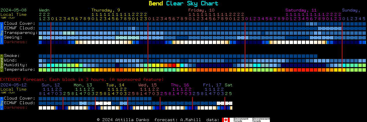
These thumbnail graphics show the cloud cover and humidity forecast for the next 48 hours at the RECON locations listed. The sites are listed from north to south. The red lines denote local midnight. You can click your community name to see a more detailed chart. All graphics and forecasts provided in this format by the Clear Sky Clock.
 |
Oroville |
| (unavailable) | Tonasket |
| (unavailable) | Okanogan |
 |
Brewster |
 |
Chelan/Manson |
 |
Entiat |
 |
Wenatchee |
 |
Ellensburg |
 |
Yakima |
| (unavailable) | White Swan/Toppenish |
 |
Pasco |
 |
Pacific NW Regional Observatory |
 |
Umatilla |
 |
Goldendale |
 |
The Dalles |
 |
Maupin |
| (unavailable) | Madras/Culver |
 |
Sisters |
 |
Redmond |
 |
Bend |
 |
Oregon Observatory |
 |
La Pine/Gilchrist |
 |
North Lake |
 |
Paisley |
 |
Chiloquin |
 |
Klamath Falls |
| (unavailable) | Lakeview |
 |
Tulelake |
 |
Cedarville |
 |
Fall River/Burney |
 |
Susanville |
 |
Greenville |
 |
Quincy |
 |
Portola |
 |
Reno |
 |
Carson City |
 |
Yerington |
 |
Gardnerville |
 |
Hawthorne |
 |
Tonopah |
 |
Lee Vining |
 |
Bishop |
| (unavailable) | Beatty |
| (unavailable) | Lone Pine |
 |
Indian Springs |
 |
Henderson |
| (unavailable) | Searchlight/Boulder City |
 |
San Luis Obispo |
 |
Kingman/Dolan Springs |
 |
Laughlin/Bullhead City |
 |
Mohave Valley |
 |
Lake Havasu |
 |
Parker |
 |
Idyllwild |
 |
Blythe |
| (unavailable) | Calipatria |
 |
Yuma |
Below are more detailed charts for each site, same order as above. (Some charts are currently unavailable)
Pacific NW Regional Observatory


